India is often called a "mini-continent"A large landmass with so many different physical features — mountains, plains, deserts, plateaus, coasts — that it resembles an entire continent in its variety. because of the extraordinary variety of its physical features. From the tallest mountains on Earth to vast flat plains, scorching deserts to lush tropical coasts — India has it all within a single country!
Geographical diversity means the different types of landformsNatural features of the Earth's surface such as mountains, hills, plains, plateaus, valleys, and deserts. and physical features found across a region.
Five Major Physical Divisions
India's landforms can be grouped into five major physical divisions:
The Himalayan Mountains — towering snow-capped ranges in the north
The Northern Plains — vast flat fertile land created by rivers
The Thar Desert — the great sandy desert of the northwest
The Peninsular Plateau — ancient elevated flatlands of central-south India
The Coastal Plains & Islands — narrow strips along the sea and island groups
Click each zone to explore India's five physical divisions
Click or tap any coloured zone on the map to learn more about that physical division.
Key Fact
India's geography directly affects the lifestyle, culture, food, clothing, and settlement patterns of its people. Mountain people build differently from desert people, and coastal communities live differently from those on plains!
What are Hills, Valleys & Plateaus?
Before exploring India's physical divisions, let's understand three key landforms you'll see everywhere:
NILGIRI HILLS, TAMIL NADU
Hill
A naturally raised area of land, smaller and lower than a mountain (generally below 600 m). Hills have rounded tops and gentle slopes.
A low area of land between hills or mountains, often with a river flowing through it. Valleys are usually V-shaped (formed by rivers) or U-shaped (formed by glaciers).
INDIAN EXAMPLES
Kashmir Valley, Kullu Valley (Himachal), Dehradun (Dun Valley), Brahmaputra Valley (Assam)
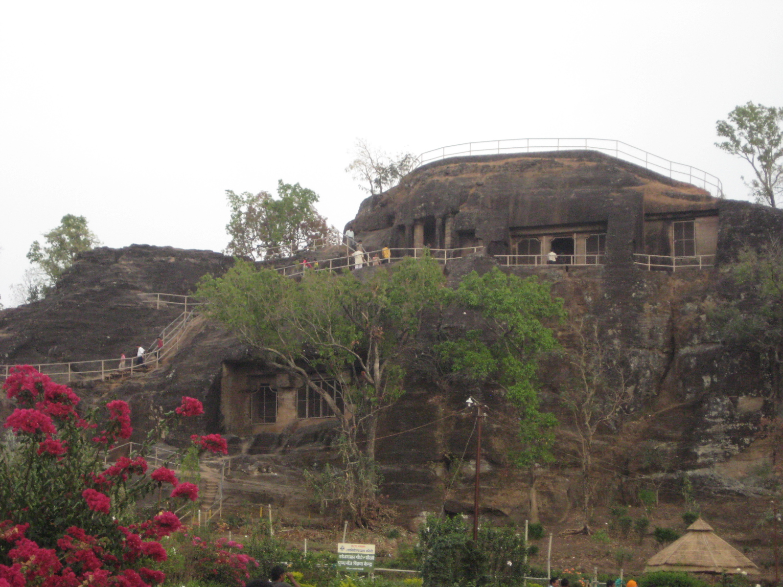
PACHMARHI PLATEAU, MP
Plateau
An elevated flat-topped area of land that rises sharply above the surrounding area on at least one side. Unlike mountains, plateaus have flat tops — like a table!
The world's mightiest mountain range — India's northern wall
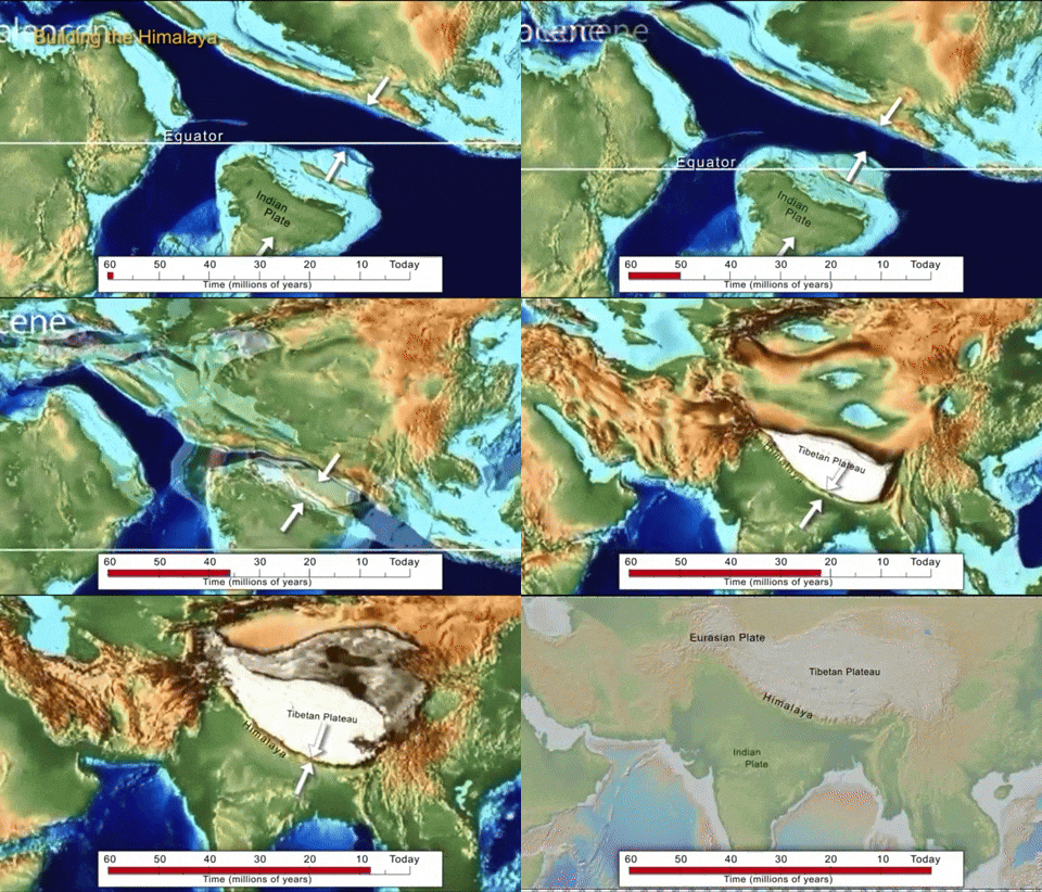
How Were the Himalayas Formed?
The Indian plate drifted north and collided with Eurasia, pushing up the Himalayas
Geographical Extent
The Himalayas stretch for approximately 2,500 km from west to east, passing through six countries: India, Nepal, Bhutan, China (Tibet), Pakistan, and Afghanistan. They form a massive arc across India's northern border.
Key Fact — "Water Tower of Asia"
The Himalayas are called the "Water Tower of Asia" because their glaciers and snow feed major rivers — Ganga, Indus, and Brahmaputra — that provide water to billions of people across South Asia.
Three Parallel Ranges
The Himalayas are divided into three parallel ranges running from west to east:
Feature
Himadri (Greater)
Himachal (Lesser)
Shivalik (Outer)
Position
Innermost / Northernmost
Middle range
Outermost / Southernmost
Average Height
6,000 m+ (peaks over 8,000 m)
3,000 – 5,000 m
900 – 1,200 m
Snow Cover
Permanently snow-covered
Snowfall in winter
No permanent snow
Characteristics
Tallest peaks, glaciers, rugged terrain
Hill stations, valleys (like Kashmir, Kullu)
Dense forests, foothills, wide valleys called DunsWide, flat valleys found between the Shivalik hills and the Himachal range. Dehradun is a famous example.
Major Peaks
Mt. Everest (8,849 m), Kanchenjunga (8,586 m)
Pir Panjal, Dhauladhar ranges
No major peaks
Settlements
Very sparse, high-altitude villages
Hill towns: Shimla, Manali, Srinagar
Foothill towns: Dehradun, Haridwar
The Himalayan Range — Interactive Map
Click any Himalayan division, peak, or hill station to see details.
Eight-Thousanders & Major Peaks
Peaks above 8,000 metres are called "Eight-Thousanders"Mountains with summit elevations over 8,000 metres above sea level. All 14 of the world's eight-thousanders are in the Himalayas and the connected Karakoram range.. The Himalayas contain all 14 of the world's eight-thousanders, including:
Mount Everest (8,849 m) — highest peak on Earth, on Nepal-China border
Kanchenjunga (8,586 m) — highest peak visible from India (Sikkim border)
Rivers from the Himalayas
Three of India's mightiest river systems originate in the Himalayas:
Ganga — begins as the Bhagirathi from the Gaumukh glacier (snout of the Gangotri Glacier) in Uttarakhand
Indus — originates near Lake Mansarovar in Tibet, flows through Ladakh and into Pakistan
Brahmaputra — starts in Tibet as Tsangpo, enters India through Arunachal Pradesh
Key Fact — Gaumukh
Gaumukh ("cow's mouth") is the terminus of the Gangotri Glacier at about 4,023 m altitude in Uttarakhand. It is the source of the Bhagirathi river, which later becomes the Ganga — India's most sacred river.
Ladakh — Cold Desert
Located between the Himadri and the Karakoram ranges, Ladakh (Union Territory since 2019) is a high-altitude cold desertA desert formed not because of heat but because of extreme altitude and rain-shadow effect. Very cold, very dry, with temperatures dropping to -30°C or below in winter.. Winter temperatures can plummet to -30°C. Despite harsh conditions, people have adapted with unique architecture and terraced farming.
Great Himalayan National Park
Located in Himachal Pradesh, this UNESCO World Heritage Site protects some of the most biodiverse ecosystems in the Himalayas. It is home to the snow leopard, Himalayan brown bear, musk deer, and hundreds of bird species.
Himalayan States & Cultural Significance
The Indian Himalayan region includes: Jammu & Kashmir (UT), Ladakh (UT), Himachal Pradesh, Uttarakhand, Sikkim, and Arunachal Pradesh.
The Himalayas hold immense sacred significance — they are home to ancient temples, Buddhist monasteries, pilgrimage routes (Char Dham), and are considered the abode of the gods in Hindu mythology.
Traditional mountain architecture includes Kath-Kuni (stone-and-wood layered construction in Himachal) and Dhajji-Dewari (timber-frame with masonry infill in Kashmir) — both designed to withstand earthquakes.
Activity 1
Match the Peak / Feature to the Correct Himalayan Division
Click a feature on the left, then click its matching division on the right.
Mt. Everest (8,849 m)
Himadri
Shimla & Manali (hill stations)
Himachal
Dehradun valley (Dun)
Shivalik
Kanchenjunga (8,586 m)
Himadri
Pir Panjal Range
Himachal
Quiz 1 — The Mighty Himalayas
3. The Northern Plains
India's vast, fertile heartland formed by mighty rivers
Formation of the Plains
The Northern Plains were formed by alluvialAlluvial refers to sediment (silt, sand, clay) deposited by flowing rivers. Alluvial soil is extremely fertile, making it ideal for agriculture. deposits brought down by three major river systems — the Indus, Ganga, and Brahmaputra — and their tributaries over millions of years. As rivers flow down from the Himalayas, they carry sediment that gets deposited on the flat land below, building up layers of fertile soil sometimes over 2,000 metres deep!
How the Northern Plains Were Formed
Characteristics
Extent: ~3,200 km from east to west, making it one of the largest stretches of flat, fertile land in the world
Terrain: Almost perfectly flat with a very gentle slope
Soil: Extremely fertile alluvial soil — ideal for farming
Population: One of the most densely populated regions on Earth due to fertile land, water availability, and flat terrain for settlement
Bhangar & Khadar
The Northern Plains have two types of alluvial land:
Bhangar — Older alluviumMaterial (soil, silt, sand, gravel) deposited by a river. Over time, alluvium builds up to form flat plains. The Northern Plains are made entirely of alluvium. found above the flood plains. This is higher, older land that is less fertile but good for settlement.
Khadar — Newer alluvium found in the flood plains of rivers. This land gets flooded regularly, receiving fresh silt deposits that make it extremely fertile — ideal for farming.
The Northern Plains — Rivers & Features
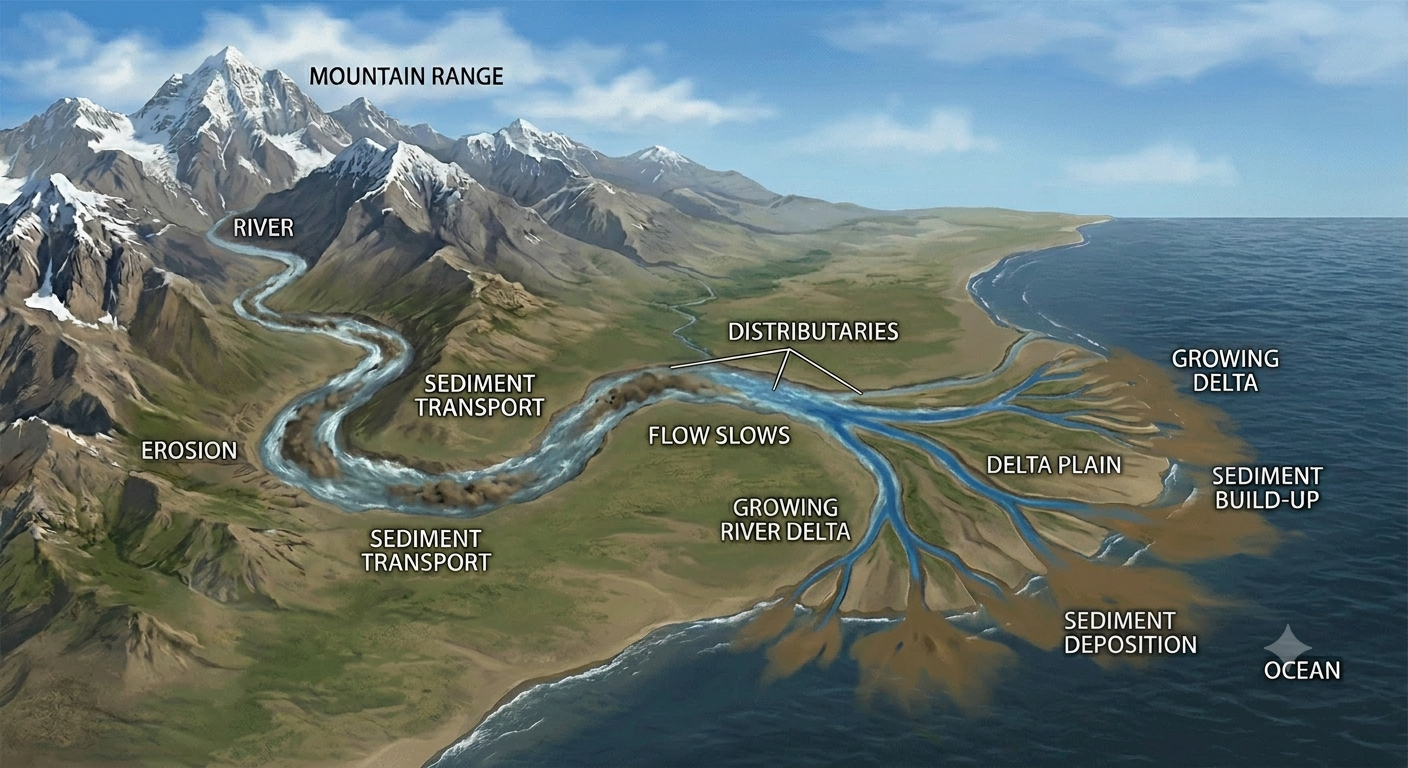
How a River Delta Forms
Rivers carry sediment from mountains and deposit it where they meet the ocean, forming a delta
Animation: How a river delta forms over time
Sundarbans Delta
Where the Ganga and Brahmaputra meet the Bay of Bengal, they form the Sundarbans — the world's largest mangrove forest and a UNESCO World Heritage Site. It is home to the Royal Bengal Tiger and unique biodiversity. The delta covers about 10,000 km².
Key Fact — Breadbasket of India
The Northern Plains produce a huge share of India's food grains (wheat, rice, sugarcane) thanks to their incredibly fertile alluvial soil and abundant river water. States like Punjab, Haryana, and Uttar Pradesh are India's top food producers.
4. The Thar Desert
The Great Indian Desert — land of sand, resilience, and adaptation
Location & Extent
The Thar Desert (also called the Great Indian Desert) is located in northwestern India, primarily in the state of Rajasthan. It covers approximately 200,000 km², making it the world's 17th largest desert.
About 85% of the Thar lies within India; the remaining 15% extends into Pakistan (Sindh and Punjab provinces)
The Thar forms a natural boundary between India and Pakistan along much of the western border
It is the world's most densely populated desert, with people adapting remarkably to harsh conditions
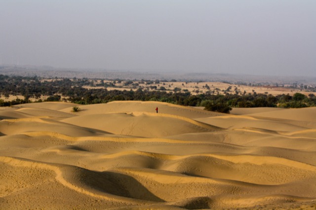
The Thar Desert — Landscapes
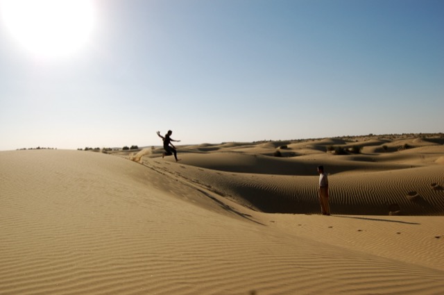
Sand Dunes — Jaisalmer
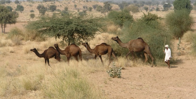
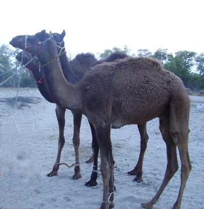
Camels in the Thar Desert
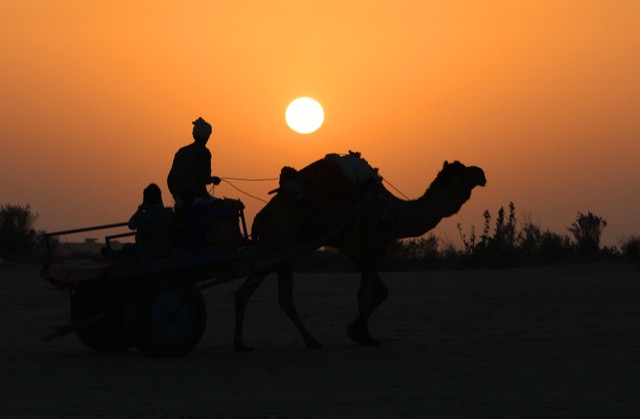
Desert Sunset
The Thar Desert — Location Map
Life in the Desert
Water management is critical — communities depend on wells, oases, and traditional water harvesting systems like tankas (underground tanks) and johads (check dams)
Settlement patterns — villages cluster around water sources; houses are built with thick walls to keep interiors cool
Adaptation — people wear light, loose clothing; camels are used for transport; agriculture relies on drought-resistant crops like bajra and jowar
Life in the Desert — Visual Guide
Camel
"Ship of the Desert" — transport & milk
Desert Landscape
Vast sandy terrain of the Thar
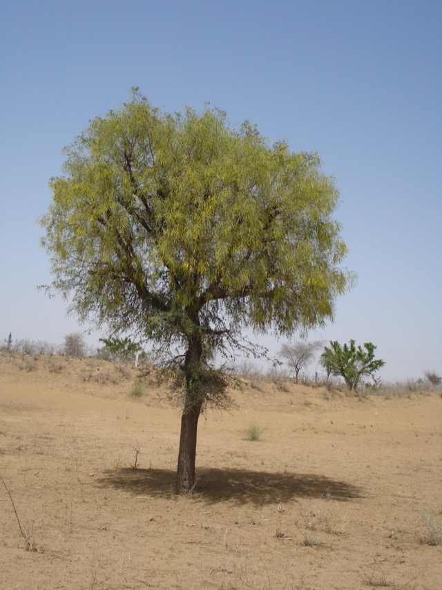
Khejri Tree
Sacred tree of the Thar — drought-resistant
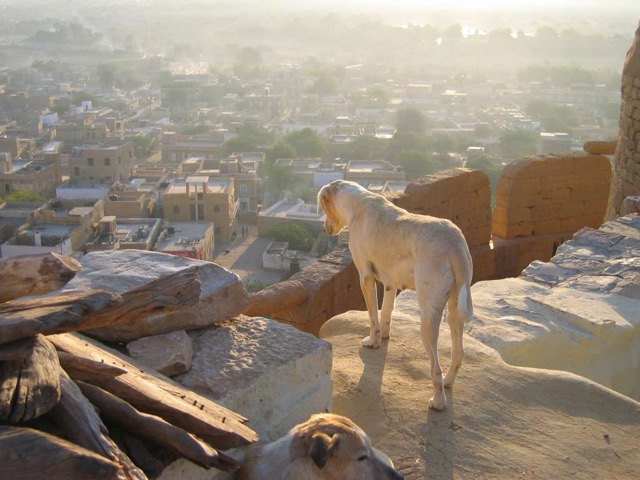
Jaisalmer City View
The golden city seen from the fort
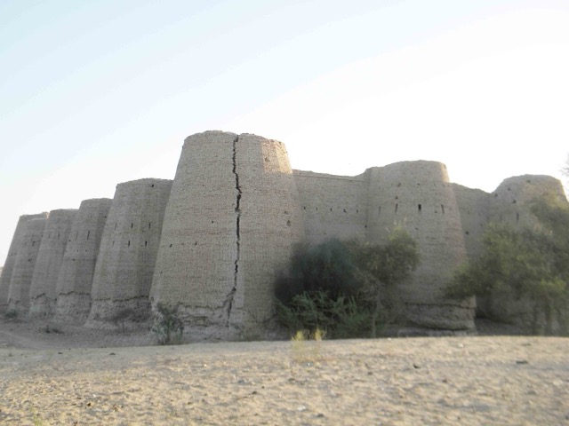
Desert Settlement
Jaisalmer — Golden City built from sandstone
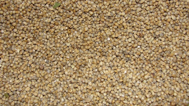
Bajra (Pearl Millet)
Drought-resistant staple food crop
Key Fact — Natural Boundary
The Thar Desert acts as a natural boundary between India and Pakistan. Its inhospitable terrain has historically served as a natural defense barrier along India's western frontier.
5. The Aravalli Hills
One of the oldest mountain ranges on Earth
Ancient Mountains
The Aravalli Hills are one of the oldest mountain ranges in the world, estimated to be about 350 million years old (compared to the Himalayas at about 50 million years). They run for approximately 800 km from Delhi in the northeast to Ahmedabad (Gujarat) in the southwest, passing through Rajasthan and Haryana.
Aravalli Hills — From Delhi to Gujarat (800 km)
Characteristics
Much lower than the Himalayas — the highest peak is Guru Shikhar (1,722 m) on Mount Abu in Rajasthan
Heavily eroded over hundreds of millions of years, making them rounded and much shorter than they once were
Act as a natural dividing line between the Thar Desert to the west and the more fertile lands to the east
Rich in minerals — marble, granite, and other building stones are quarried from the Aravallis
Key Fact — World's Oldest
At approximately 350 million years old, the Aravallis are among the oldest fold mountains on Earth. They were once as tall as the Himalayas but have been worn down by erosion over hundreds of millions of years!
Significance
Natural barrier — prevents the Thar Desert from spreading eastward
Historical importance — many forts and palaces of Rajput rulers were built on Aravalli hilltops (e.g., forts of Udaipur, Kumbalgarh)
Mount Abu — the only hill station in Rajasthan, located in the Aravallis, known for the beautiful Dilwara Temples
6. The Peninsular Plateau
India's ancient, elevated heartland — the Deccan and the Ghats
India's Largest Physical Division
The Peninsular PlateauA peninsula is land surrounded by water on three sides. The Peninsular Plateau is the large, elevated, flat-topped landmass of southern India, surrounded by the Arabian Sea, Bay of Bengal, and Indian Ocean. is the largest physical subdivision of India. It is an ancient landmass — a remnant of Gondwana — made up of some of the oldest rocks on Earth (igneous and metamorphic rocks).
Average elevation: 600–900 metres above sea level
Terrain: Gently sloping plateauAn elevated flat-topped area of land. Unlike mountains (which are pointed), plateaus have relatively flat tops. The Deccan Plateau is a classic example. with wide valleys between mountain ranges
Rocks: Ancient igneous and metamorphic rocks (granite, basalt, gneiss)
Rich in minerals: Iron ore, manganese, coal, bauxite, mica
The Peninsular Plateau — Deccan, Western & Eastern Ghats
Click the Deccan Plateau, Western Ghats, or Eastern Ghats for details.
Western Ghats
Run along the western edge of the plateau, parallel to the Arabian Sea coast
Steep slopes facing the sea (escarpment)
Higher than Eastern Ghats (average 1,200 m)
Known as Sahyadri in Maharashtra
UNESCO World Heritage biodiversity hotspot
Eastern Ghats
Run along the eastern edge, parallel to the Bay of Bengal coast
Gentler, lower slopes compared to Western Ghats
Discontinuous — broken by rivers like Godavari, Krishna, and Kaveri
Average height around 600 m
Major Rivers of the Plateau
Narmada — flows westward into the Arabian Sea (one of the few west-flowing rivers)
Godavari — longest river of peninsular India, called "Dakshin Ganga"
Krishna — originates near Mahabaleshwar, flows east into Bay of Bengal
7. Coastal Plains & Islands
India's long coastline, coral islands, and the Andaman chain
West Coast (Arabian Sea)
Narrow coastal strip between Western Ghats and the Arabian Sea
Includes the Konkan (Maharashtra, Goa), Kanara (Karnataka), and Malabar (Kerala) coasts
Important ports: Mumbai, Goa, Kochi
Known for fishing, coconut cultivation, and maritime trade
East Coast (Bay of Bengal)
Broader coastal plain compared to the west coast
Includes the Coromandel coast (Tamil Nadu, Andhra Pradesh) and Northern Circars
Important ports: Chennai, Visakhapatnam, Kolkata
Rich deltaA triangular area of land formed at the mouth of a river where it meets the sea. Rivers deposit sediment here, creating flat, fertile land. Major Indian deltas include the Sundarbans (Ganga) and the Godavari delta. regions formed by major rivers
Coastal Plains & Island Groups
Click the West Coast, East Coast, Lakshadweep, or Andaman & Nicobar for details.
Lakshadweep Islands
Group of 36 coral islands in the Arabian Sea
Located about 200-440 km off the southwestern coast of India (Kerala)
Formed by coralCoral islands are formed by the accumulation of coral reefs — structures built by tiny marine organisms called coral polyps. Over thousands of years, coral builds up to form islands. reef buildup over thousands of years
Very small in area — total land area only about 32 km²
India's smallest Union Territory
Andaman & Nicobar Islands
Chain of 572 islands in the Bay of Bengal
Geologically a continuation of the Arakan mountain range (Myanmar) that was submerged under the sea
Continental origin (not coral like Lakshadweep)
India's southernmost point — Indira Point (Great Nicobar)
Strategically located near major shipping routes
Rich in biodiversity with unique endemic species
Key Fact — Two Different Origins
India's two island groups have completely different origins: Lakshadweep islands are made of coral (living organisms building up over millennia), while the Andaman & Nicobar islands are the tops of a submerged mountain range (Arakan) — essentially mountains whose bases are underwater!
Activity 2
Island Explorer — Coral or Continental?
Click each feature, then select whether it describes Lakshadweep (Coral) or Andaman & Nicobar (Continental).
Located in the Arabian Sea
Continuation of the Arakan mountain range
Made of coral reef buildup
Contains India's southernmost point (Indira Point)
India's smallest Union Territory by area
8. Northeast Hills & Special Regions
India's green paradise — hills, biodiversity, and unique communities
The Northeast Hills
India's northeast is a region of stunning hills, valleys, and plateaus that are geographically distinct from both the Himalayas and the Peninsular Plateau. The states of Meghalaya, Nagaland, Manipur, Mizoram, Tripura, and parts of Assam and Arunachal Pradesh are characterised by hilly terrain.
Meghalaya Plateau — an extension of the Peninsular Plateau, separated by a gap (the Garo-Rajmahal gap)
Purvanchal — the eastern hill ranges including the Patkai, Naga, Lushai (Mizo), and Manipur hills
One of the world's biodiversity hotspots — home to an extraordinary variety of plant and animal species
Key Fact — Mawlynnong
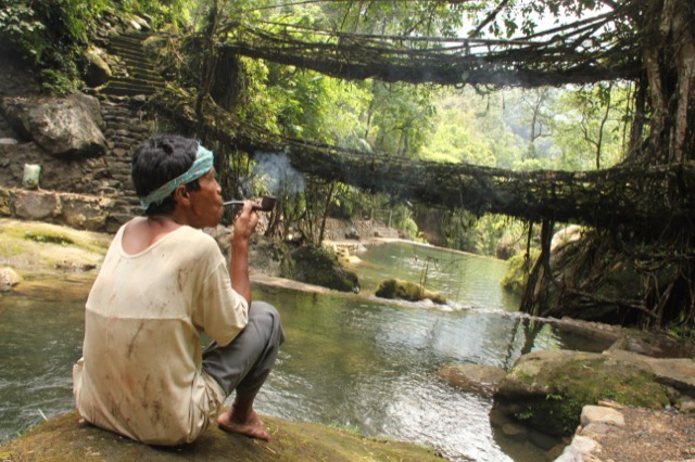
Mawlynnong village in Meghalaya has been recognised as the cleanest village in Asia. The community maintains spotless cleanliness through collective effort. The village also has a fascinating "living root bridge" made from the aerial roots of rubber fig trees — a marvel of indigenous engineering!
Unique Features
Living root bridges — in Meghalaya, the Khasi and Jaintia communities grow bridges from tree roots that can last for centuries
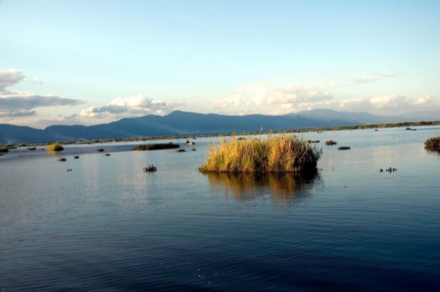
Loktak Lake (Manipur) — largest freshwater lake in northeast India, famous for floating "phumdis" (vegetation islands)
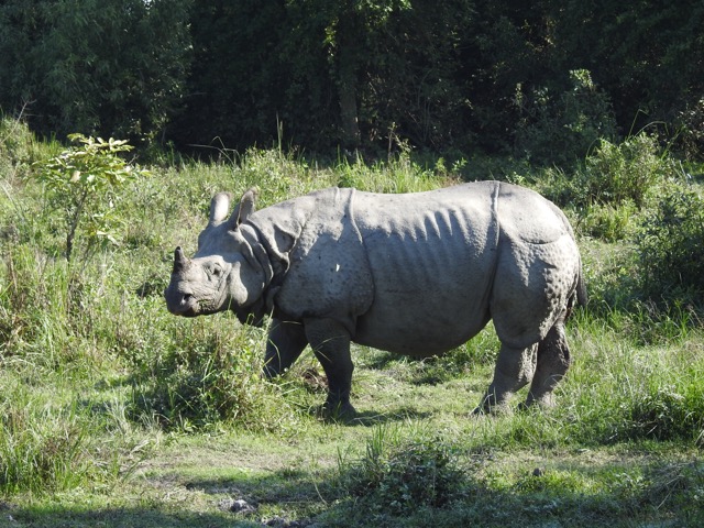
One-horned rhinoceros — found in Kaziranga National Park, Assam (World Heritage Site)
Rich tribal cultures with diverse languages, festivals, and traditions
Strategic location sharing borders with Bangladesh, Myanmar, China, and Bhutan
Northeast India — Photo Gallery
Living Root Bridge
Nongriat, Meghalaya
Loktak Lake
Manipur — floating phumdis
One-Horned Rhino
Kaziranga, Assam
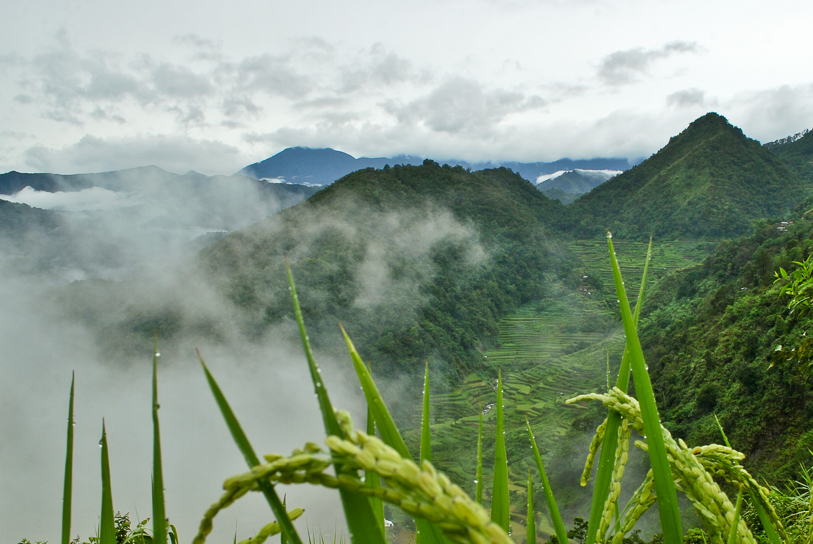
Terrace Farming
Step-farming on hillsides
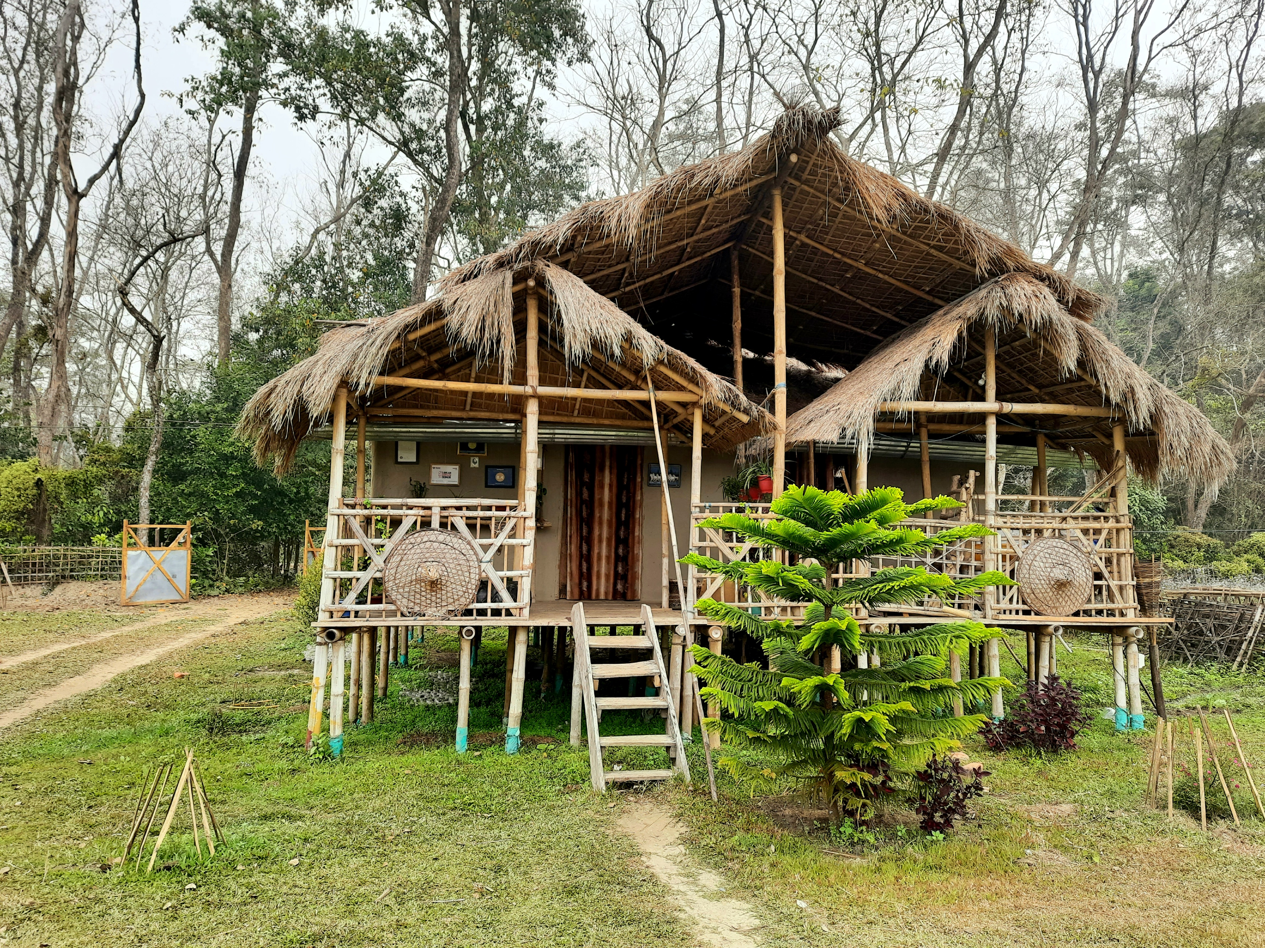
Bamboo Houses
Mishing house, Majuli, Assam
Impact on Life
The hilly terrain of the northeast greatly influences how people live:
Terrace farming — hillsides are cut into step-like terraces for growing rice and other crops
Bamboo is used extensively for houses, bridges, furniture, and everyday items
Jhum cultivation (shifting cultivation) is traditionally practised, where forest patches are cleared, farmed for a few years, then left to recover
Villages are often built on hilltops or ridges for defense and drainage
Quiz 2 — All Regions of India
Locate on the Map!
Test your knowledge of India's physical features! Read the question and tap the correct region on the map. 5 questions drawn from a pool of 10 — every round is different!
Locate on the Map!
Tap the correct region on the map
Question 1 of 5Score: 0 / 5
...
Click a region on the map to answer!
Quiz Complete!
0 / 5
Interactive Activities
Test your knowledge with these hands-on challenges
Activity 3
Match the River to Its Origin
Click a river on the left, then click its origin on the right.
Ganga (Bhagirathi)
Gaumukh Glacier, Uttarakhand
Indus
Near Lake Mansarovar, Tibet
Brahmaputra
Tibet (as Tsangpo), enters via Arunachal Pradesh
Godavari
Nashik, Maharashtra (Peninsular Plateau)
Activity 4
Name That Landform!
Read the description and select the correct physical division.
Clue 1
"I am the world's 17th largest desert. About 85% of me lies in India. I form a natural boundary with Pakistan."
Clue 2
"I am 350 million years old — one of the oldest fold mountains. My highest peak is Guru Shikhar at 1,722 m."
Clue 3
"I am a chain of 572 islands in the Bay of Bengal. I am actually the continuation of a submerged mountain range."
Clue 4
"I stretch 3,200 km from east to west. My soil is alluvium deposited by rivers and goes 2,000 m deep."
Clue 5
"My village Mawlynnong is known as the cleanest in Asia. I am in the northeast and have living root bridges."
Activity 5
Why Do People Settle Here?
Match each settlement reason to the correct region.
"Fertile alluvial soil for farming"
Northern Plains
"Natural harbour for maritime trade"
Coastal Plains
"Near wells and oases in arid land"
Thar Desert
"Hilltop location for defense and drainage"
Northeast Hills
Chapter Summary & Review
India is called a "mini-continent" due to its extraordinary variety of landforms
The Himalayas (2,500 km long) have three divisions — Himadri, Himachal, and Shivalik — formed by the collision of Indian and Eurasian plates
The Himalayas are the "Water Tower of Asia", feeding the Ganga, Indus, and Brahmaputra
The Northern Plains (3,200 km) are formed by alluvial deposits, with Bhangar (older) and Khadar (newer) soils
The Thar Desert (~200,000 km²) forms a natural India-Pakistan boundary
The Aravalli Hills (~350 million years old) are among Earth's oldest mountain ranges
The Peninsular Plateau (Deccan) is India's largest physical division, flanked by Western and Eastern Ghats
Lakshadweep = coral islands (Arabian Sea); Andaman & Nicobar = continuation of Arakan range (Bay of Bengal)
The Northeast has unique hills, biodiversity hotspots, and Mawlynnong — Asia's cleanest village
Review Questions
Why is India called a "mini-continent"?
Name the three parallel ranges of the Himalayas with their key features.
What is the difference between Bhangar and Khadar?
How do the Lakshadweep and Andaman & Nicobar islands differ in their origin?
Why are the Himalayas called the "Water Tower of Asia"?